Partially supported by a NULab Seedling Grant.
The Mapping Social Infrastructure project aims to comprehensively map the social infrastructure of the entire United States. Social infrastructure refers to the physical spaces and events in communities that build social capital, the social ties among residents that enable trust, reciprocity, and collective action. As described in Eric Klinenberg’s landmark 2018 book Palaces for the People, sites like libraries, community centers, parks, and sports fields have been shown to make meaningful differences in neighborhood social capital, health, and political polarization. These sites may be key to resilience during the COVID-19 pandemic as well, because they provide safer spaces for residents to interact in a masked, socially distanced capacity, and share important information to residents from all income and educational backgrounds. Like the American Society of Civil Engineers releases each year a state-by-state report card for physical infrastructure, this project aims to create a community-by-community report card for social infrastructure for the entire United States. Together, members of the Aldrich Resilience Lab will map the geocoded locations of social infrastructure sites throughout the country. This project will map these sites using the Google Maps Places API, creating spatially-smoothed estimates of the number of social infrastructure sites per 100,000 residents for every census tract, city, county, and state.
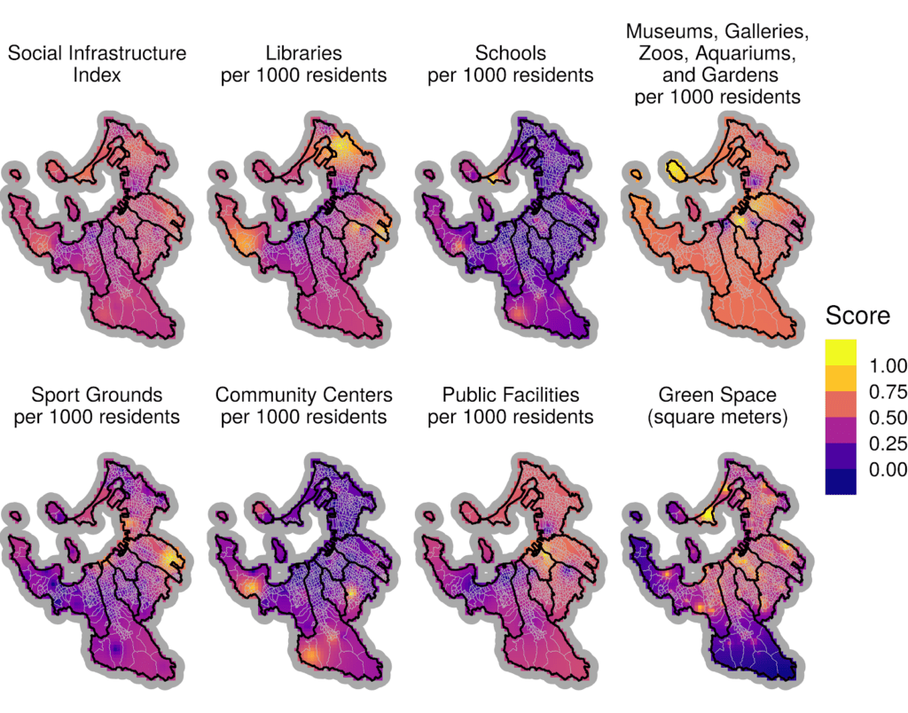
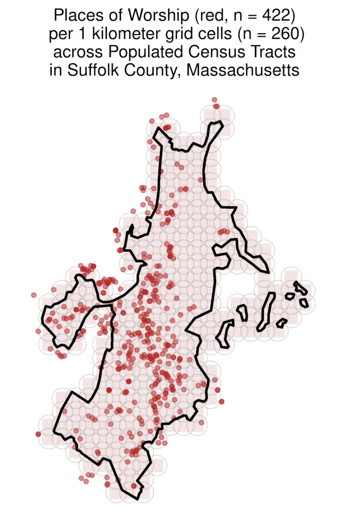
Why should residents care about social infrastructure and the social ties these sites build? When crisis strikes, communities with stronger social capital tend to evacuate, shelter, recover, and rebuild better than others, both after floods, hurricanes, and fires, but also pandemics. New measures of social capital at the county level, as well as at city, zipcode, and census tract levels suggest that these social ties can help reduce the spread of COVID19. Early work-in-progress has similarly suggested that communities with more parks, libraries, zoos, botanical gardens, and more have seen less spread during the COVID19 pandemic and fewer suicides. The team’s early work has mapped social infrastructure in Fukuoka City in Japan, as pictured in Figure 1. Next, as a pilot project, the team will map the social infrastructure of Boston, as exemplified in Figure 2. before scaling up to state and national levels. Scholars can use this project’s data to test and predict social-capital related outcomes, including mental health and anxiety, political polarization, community cohesion, the types of social ties each kind of social infrastructure fosters, and communities’ resilience and responses to the COVID-19 pandemic, among other disasters.
Figure 1: Example of Spatially Smoothed Maps of Social Infrastructure Data in Fukuoka, Japan

Figure 2: Example of Mapping Social Infrastructure in Boston with the Google Places API

Principal Investigators
Timothy Fraser, PhD Candidate in Political Science; Courtney Page-Tan, Aldrich Resilience Lab Alumnus and Fellow; Daniel P. Aldrich, Faculty, School of Public Policy & Urban Affairs, and colleagues at the Aldrich Resilience Lab


